2019 News Archive
Limits to Growth Falsified – the Accessible Earth Contains a Truly Enormous Amount of Copper (Open Access Paper) (December 19, 2019)
You do remember the book published by Meadows et al. (1970) on The Limits to Growth? It was written as a report to the famous Club of Rome and had a global impact by announcing an apocalypse on the doorstep. The green movement experienced a decisive boost. One of the predictions concerned minerals and metals that would fail to support further quantitative and qualitative growth of the global population. Since then, humanity has grown by the billions and a great part of China' s population has risen out of poverty and attained material prosperity. Raw materials are plentiful. Nevertheless, media and some scientists continue to predict an approaching end to supplies. Stock markets may have an interest to boost anxiety (and prices), but scientists?
Aiming at a thorough rebuttal to these recurring errors, six leading geoscientists combined their competence and elaborated a voluminous investigation on the availability of copper (Arndt et al. 2017), serving as an example for most other raw materials.
The authors aim to explain and to illustrate methods of estimating total or ultimate resources on our globe. They start out explaining the difference between reserves and resources. As you know, reserves are thoroughly investigated ore volumes that are proven to be economically exploitable. Divided by annual mine production (21 Mt in 2018), reserves typically suffice for 20 to 50 years (life index), but as they are continuously replenished, this is not equal to the ultimate availability of the respective metal or mineral. Resources are less well known or unknown (undiscovered, prognostic, speculative). It is the speculative resource class that is the decisive unknown.
A fairly voluminous, richly illustrated section 2 on ore deposit classes and geological settings provides a basic understanding of economic geology. The search for ore (exploration) is explained in section 3. Mining history, modern extraction and ore dressing follows in section 4.
It is section 5, Estimating Ultimate Resources, the Earth' s entire inventory, that finally provides answers (lead authors Steve Kesler and Nicholas Arndt). Methods presented include a) production-based (the Hubbert curve peak) and b) geology-based groups. You must have read of the Hubbert peak method because this is much discussed in the media. In Arndt et al. (2017) on page 123, you may consult the equations used by Hubbert. Applied to copper, the method a) is judged unsatisfactory (p 126).
Geology-based estimates developed by the USGS result in giant ultimate resources (2x10 11 tonnes), although still emulating present-day conditions and knowledge. The USGS three-part assessment system is accessible in Singer & Menzie (2010). Considering future advances in technology, extraction of low grade mineralisation (less than present ore) is likely, and cut-off grade may fall to about 300 ppm, 10 times the average contents of upper crustal rocks (30 ppm Cu). Available data support a unimodal distribution of Cu from ore to the crustal average, and the presence of Cu in sulfides minerals. Resources of ultimate copper in the uppermost 3.3 km of the Earth' s crust is estimated by Arndt et al. (2017) to about 1 x 10 13 tonnes Cu metal (Figure 5.8, p. 137).
The conclusion of Arndt et al. (2017) is that the accessible Earth contains a truly enormous amount of copper, and by deduction, of other metals and minerals. This is my own opinion also (WL Pohl in print), and personally I would stress that recent scientific and technological progress projected into the future shall reach unexpected and unimaginable solutions. Let us trust in human inventiveness to care for later generations and, according to the Rio Declaration (UN Conference on Environment and Development 1992), let us allow now for the interests of the living generation of humans.
The authors take a bold step towards approaching an estimate of truly ultimate resources of raw materials accessible to humans. Their paper is not for the faint-hearted. It is a useful source of arguments for confronting apokalyptic doomsters. Its last 30 pages provide Appendixes to section 3 with brief additions to Exploration, Geochemistry, Geophysics, Drilling, and an Index. Throughout, figures and photographs are excellent. Locations and mines mentioned cover both Americas and the globe. Yet, the flavour of the book is predominantly North American. Some recent great Australian and Chinese contributions to economic geology are not mentioned, such as the mineral system concept (Skirrow et al. 2019), and innovative crustal-scale deep reconnaissance reaching down to the Moho. If you are interested, please look at my Economic Geology News blog below dated October 15.
References
Arndt, N.T., Fontbote, L., Hedenquist, J.W., Kesler, St.E., Thompson, J.F.H. & Wood, D.G. (2017) Future global mineral resources. Geochemical Perspectives 6, 1-171. Open access. doi: 10.7185/geochempersp.6.1 | Full text PDF (28 MB)
Meadows, D. L. et al. (1974) The limits to growth. A report for the Club of Rome' s project on the predicament of mankind. 2nd ed., 205 pp. Universe Books, New York.
Pohl W.L. (in print) Economic Geology, Principles and Practice: Metals, Minerals, Coal and Hydrocarbons – an Introduction to Formation and Sustainable Exploitation of Mineral Deposits. 2nd ed. 766 pp. Schweizerbart Science Publishers, Stuttgart.
Singer, D.A. & Menzie, W.D. (2010) Quantitative mineral resource assessments: an integrated appoach. 232 pp. Oxford University Press.
Skirrow, R.G., Murr, J., Schofield, A., et al. (2019) Mapping iron oxide Cu-Au (IOCG) mineral potential in Australia using a knowledge-driven mineral systems-based approach. Ore Geology Reviews 113, 103011. Open access. https://doi.org/10.1016/j.oregeorev.2019.103011
Back to top
Home
Paradigmatic Australian Paper on Mineral System Analysis in Prospectivity Mapping (Open Access) (October 15, 2019)
Currently in remote NW Australia, Rio Tinto Exploration is investing heavily in detailed investigations of the Winu Cu-Au Prospect (Rio Tinto 2019). Because of the nature and extent of the mineralisation, this find rouses hopes and much interest. You can follow the case in a progression of ASX (Australian Stock Exchange) reports. The mineralisation consists of ore veinlets in hard-rock Proterozoic sediments that are covered by subrecent sands. Primary sulfides are upgraded by supergene enrichment. Winu is a shallow find (<500 m) and is not yet settled as an economically exploitable deposit. Meanwhile, Australia is enabling itself to locate much deeper targets. This is the subject of the paper by Skirrow et al. (2019) that I will present here.
Today, deep exploration increasingly targets large buried deposits and the search is guided by geological concepts. Multi-professional teams use large data sets, systematic methodology and latest technologies. Yet, experienced individuals with exceptional metallogenetic knowledge may still be the key to success (Sillitoe et al. 2017).
Modern exploration for minerals and metals is based on mineral system analysis (Wyborn et al. 1994) that I propose to be synonymous with 'digital–age quantitative metallogeny' (Pohl in print). The method emulates the 'petroleum system' approach that for decades already is successfully employed in the oil and gas industry. The depth of oil and gas deposits, however, is commonly more than 5 km whereas current hard rock mining is most frequent between 0-500 m below the surface, and exceptionally down to 4000 m (Au in the Witwatersrand).
Mineral systems analysis as practiced in Australia is the compilation of geological processes, conditions and factors that contribute to the formation of a mineral deposit. Basically, this is a scientific effort to build a metallogenetic model, from the source through migration to ore formation. For the purpose of exploration at continental to camp scale, mappable features are sought. These may be of geological (e.g. evolved granites, transcrustal faults), geochemical (wide halos of volatile metals such as Hg, Sb; or radioisotope mapping) and geophysical nature (seismic, magnetic, gravity, magnetotelluric spatial data).
A mineral system of hydrothermal or orthomagmatic deposits consists of the following:
- (i) Sources of ore constituents (ore metals, sulphur), fluids and ligands;
- (ii) energy source to ' drive' the ore-forming system;
- (iii) crustal and mantle lithospheric architecture or structure, representing active fluid and/or magma flow paths;
- (iv) ore depositional gradients representing spatial and/or temporal changes in physico-chemical parameters, where the ore metals and minerals are deposited.
The paper by Skirrow et al. (2019) summarises a ten-year effort by Geoscience Australia of regional exploration for deep IOCG (iron oxide-copper-gold deposits). The archetype of this deposit class is the giant Cu-Au-Ag-U-REE Olympic Dam deposit in South Australia, but many more are known in other Australian states, and globally. Find details about Olympic Dam in my Economic Geology 2nd ed. (Pohl in print). Total resources of Olympic Dam are estimated to 10,000 Mt at 0.77 wt.% Cu, 250 ppm U3O8, 0.32 g/t Au and 1 g/t Ag (Ehrig et al. 2017). For decades, Australia has built up an extensive data base that allows the application of mineral (metallogenic) models in prospectivity or mineral potential mapping. In this technology, mineral systems for specific ore deposit classes (or types) such as IOCG are assembled and data layers are scanned in GIS for the coincidence of favourable mappable features.

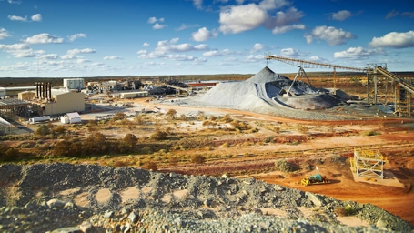
- Olympic Dam mine surface facilities and installations, aerial view. Courtesy https://www.miningmagazine.com/
Skirrow et al. (2019) patiently investigate three main themes; their deliberations will be of great assistance to science and practice of economic geology, not only concerning IOCG:
(1) What is an Iron Oxide Copper Gold deposit (key diagnostic features of IOCG globally, and what is the difference to eight similar deposit classes such as Kiruna IOA that are not IOCG);
(2) how to model the IOCG mineral system (theoretical considerations); and
(3) how to map great regions for indications of hitherto unknown IOCG (input data sets, workflow and results for five regions within Australia).
The model is underlain by diverse large geoscientific data sets, which are processed in 2D GIS. The model of IOCG mineral systems is described by theoretical (metallogenetic) and mappable criteria (shown in Table 2). The authors discuss the unresolved fluid source question of IOCG – either magmatic-hydrothermal only or non-magmatic such as basinal or metamorphic brines – and include both cases in their analysis. Table 2 occupies 3 pages and is highly revealing of details and their weighting. Extensive discussion of single criteria (e.g. fluid and metal source) across available global data on IOCG is most valuable. Workflow comprises identification of critical geological processes, their mappable features, selecting the digital spatial data best representing the mappable geological features, and assigning importance, applicability and confidence weightings to the mappable input data sets. The authors conclude by reporting the results of their work, in text and figures.
This work is a great success for Geoscience Australia, and globally, a paradigma for digital-age exploration in the 21st Century. Highly recommended!
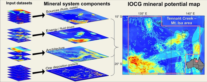
- Skirrow et al. (2019) graphical abstract showing mappable data layers (left) processed into map of IOCG prospectivity (right)
References
Ehrig, K., Kamenetsky, V.S., McPhie, J. et al. (2017) Olympic Dam iron oxide Cu-U-Au-Ag deposit. Pp 601-609 in Australian ore deposits (ed G.N. Phillips), Australasian Institute of Mining and Metallurgy.
Pohl W.L. (in print) Economic Geology, Principles and Practice: Metals, Minerals, Coal and Hydrocarbons – Introduction to Formation and Sustainable Exploitation of Mineral Deposits. 2nd ed. 766 pp. Schweizerbart Science Publishers, Stuttgart.
Rio Tinto (2019) Rio Tinto Exploration Update Winu project – copper-gold mineralisation discovered in the Paterson Province in the far east Pilbara region of Western Australia. Announcement to ASX on August 1st, 2019.
Sillitoe RH, Perello J, Creaser RA, Wilton J, Wilson A, Dawborn T (2017) Age of the Zambian Copperbelt. Miner. Deposita. doi:10.1007/s00126-017-0726-8
Skirrow, R.G., Murr, J., Schofield, A., et al. (2019) Mapping iron oxide Cu-Au (IOCG) mineral potential in Australia using a knowledge-driven mineral systems-based approach. Ore Geology Reviews 113, 103011. Open access. https://doi.org/10.1016/j.oregeorev.2019.103011
Wyborn, L.A.I., Heinrich, C.A., Jaques, A.L. (1994) Australian Proterozoic mineral systems: essential ingredients and mappable criteria. In: The AusIMM Annual Conference Proceedings. AusIMM Darwin, pp. 109–115.
Back to top
Home
Magma Fertility – A New Approach for Porphyry Cu ± Au Exploration (12 September 2019)
Faced with plug-like multiple porphyric intrusions in a suprasubduction setting the exploration team needs to identify the more favourable ones. Magma fertility evaluation is one innovative group of methods that may help in ranking. In an Open Access paper, Park et al. (2019) recently published an approach to determine Cu ±Au fertility based on PGE concentrations in porphyry rock samples.
The argument is that early sulfide segregation retains metals deep in the evolving column or while fractionating in crustal magma chambers. The resulting magma displays low PGE concentrations due to strong affinity of PGEs for immiscible sulfide melts. The plug will be barren. Magma that retained sulfur and metals to shallow levels may concentrate both chalcophile elements and sulfur by fractional crystallization before reaching volatile saturation that initiates the magmatic-hydrothermal ore-forming system.
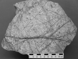
- Typical porphyry copper ore from Chuquicamata, displaying brecciation and quartz veining, pervasive sericitic (greenish) and argillic alteration. Courtesy Bernd Lehmann, Clausthal. Grey ore in veinlets is largely chalcocite due to supergene enrichment that reaches 800 m below surface. Chuquicamata is a copper-only (plus Mo-Re) deposit that features in the paper by Park et al. (2019), among others.
Plots of Pd/MgO against Pd/Pt for igneous suites can be used to estimate chalcophile element fertility and distinguish between barren, porphyry Cu, and porphyry Cu ±Au granitoid systems; ore grade, particularly gold, may be estimated. Yet, other factors such as low fluid contents indicated by the absence of profuse hydrothermal alteration may impede ore formation even if the geochemistry of the system was favourable (Park et al. 2019).
Park, J.-W., Campbell, I.H., Malaviarachchi, S.P.K. et al. (2019) Chalcophile element fertility and the formation of porphyry Cu ± Au deposits. Miner. Deposita 54, 657‑670. Open access. URL https://doi.org/10.1007/s00126-018-0834-0
Back to top
Home
Nickel Demand Rising with the e-Vehicle Wave: News from Australia (16 August 2019)
BHP Group Limited and BHP Group plc (BHP: https://www.bhp.com/) is a giant Anglo-Australian multinational mining, metals and petroleum dual-listed public company headquartered in Melbourne, Victoria, Australia. Currently, its subdivision Nickel West is investing heavily to catch the e-vehicle wave, in exploration, by opening up new mines, and by upgrading the Mt. Keith processing plant and its refinery at Kwinana. Opening up two new pits has been started. For a 60 kilowatt hour (kWh) car battery, 70 kg nickel, 11 kg lithium and 9 kg cobalt are needed. Within 10 years, nickel consumption for e-vehicles is predicted to rise to 22 times of present requirements (Glencore).
Lithium, cobalt, REE, and graphite are critical battery materials that are often discussed (read my blog below for access to production, prices and reserve figures: BPplc 2019). Nickel seems to have been disregarded, and until recently, BHP considered selling Nickel West.
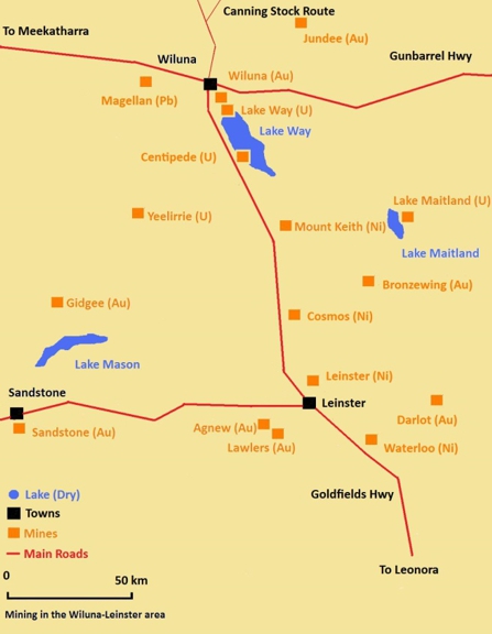
- Wiluna mining district map. Courtesy Calistemon - Own work, CC BY-SA 3.0, Commons.wikimedia.org/w/index.php?curid=13300273
The Archean komatiite-hosted nickel sulfide deposits of Western Australia were discovered in 1966 (Barnes et al. 2017). Incidentally, during the following boom, I was hired as a geologist for Ni exploration in the Wiluna district but when I arrived, the company needed my services more urgently for a copper mine in Queensland.
Nickel deposits occur in Neoarchean greenstone belts of the Yilgarn Craton. Channels of relatively thin lava flows host high-grade ore (Kambalda type) whereas thick subvolcanic feeder sills contain lower-grade disseminated but much larger orebodies. At giant Mt. Keith, past production and remaining resources add up to ~13 Mt of nickel metal contained. The district comprises five world-class nickel deposits (>1 Mt nickel contained). By-product tenors of copper, cobalt, gold and platinum metals are significant.
The origin of the giant dunite hosted deposits of the Mt. Keith trend in the Kalgoorli terrane is either shallow subvolcanic or in large extrusive lava rivers (Barnes et al. 2017). The MKD5-Mt. Keith deposit occurs within a thickened steeply dipping high-Mg ultramafic unit. A core of olivine adcumulate reaches a thickness of 350 m adjacent to olivine Ni-sulfide adcumulate, a disseminated ore (Perring et al. 2017). Mining started in 1994. The deposit comprises an endowment of 2.5 Mt Ni in total resources of 300 Mt at 0.52 wt.% Ni (including reserves).
Employing a mineral systems approach to exploration, large regions in Australia are tested for Ni-sulfide mineralization by isotopic terrane mapping and aeroelectromagnetics. On the ground, search for Ni-Cu-PGE sulfide ore is very effectively guided by geochemical methods (e.g. nickel concentrations in soil and rocks) and by petrological investigation of magmatic host rocks (keys include sulfur-saturation and PGE tenors). The first West Australian Ni deposits were found by locating gossans with peculiar green coatings (annabergite or nickel bloom). In Finland, the most prospective intrusions were found to be those that show a steep trend from high forsterite (>80 mole %) and Ni (>1500 ppm) tenors to low Ni contents (<500 ppm). This divergence suggests that sulfide segregation took place within the intrusion (Makkonen et al. 2017).
We are all aware, of course, that fully electric vehicles are only entering the battle for customers. Replacing the billions of cars on global roads has barely started. Nickel West' s expansion is a bet. May they be successful!
Note that the geology text above is an excerpt from my new book Economic Geology (second edition), that will appear early next year (Pohl 2020, in print).
References
Barnes, S.J., Mole, D.R. & Wells, M.A. (2017) Western Australia nickel overview. Pp 53-58 in Australian Ore Deposits (ed G.N. Phillips), Australasian Institute of Mining and Metallurgy.
BPplc (2019) BP Statistical Review of World Energy. 64 pp. 68th ed. URL https://www.bp.com/en/global/corporate/energy-economics/statistical-review-of-world-energy.html. June 2019. Open Access.
Makkonen, H.V., Halkoaho, T., Konnunaho, J., et al. (2017) Ni-(Cu-PGE) deposits in Finland – Geology and exploration potential. Ore Geol. Rev. 90, 667–696.
Perring, C.S., Rieuwers, M.T., Western, E.E. et al. (2017) Nickel deposits of the Mount Keith and Leinster regions, Agnew-Wiluna Belt. Pp 127 -132 in Australian Ore Deposits (ed G.N. Phillips), Australasian Institute of Mining and Metallurgy.
Pohl, W.L. (in print, January 2020) Economic Geology, Principles and Practice: Metals, Minerals, Coal and Hydrocarbons ‑ an Introduction to Formation and Sustainable Exploitation of Mineral Deposits. 2nd ed. Schweizerbart Science Publishers, Stuttgart.
Back to top
Home
The 68th edition of the Statistical Review of World Energy by BP is out. Access is free! (July 16, 2019)
If you are interested in energy data of highest quality and reliability, this is the choice. The full report numbers 64 pages, but single sections are available, including Oil, Natural gas, Coal, Nuclear, Hydro and Renewables. The materials sections provide data and graphics on Reserves, Production, Consumption, Prices, Refining and Trade. Highly interesting are introductory summaries by BP's group chief executive and the chief economist. Let me cite a passage from the first, Bob Dudley:
'Decarbonizing the power sector while also meeting the rapidly expanding demand for power, particularly in the developing world, is perhaps the single most important challenge facing the global energy system over the next 20 years. Renewable energy has a vital role to play in meeting that challenge. But it is unlikely to be able to do so on its own. A variety of different technologies and fuels are likely to be required, including extensive coal-to-gas switching and the widespread deployment of carbon capture, use and storage (CCUS)'.
The second, Spencer Dale, provides a broad summary of global energy developments in 2018, such as
'Digging into the data further, it seems that much of the surprising strength in energy consumption in 2018 may be related to weather effects. In particular, there was an unusually large number of hot and cold days across many of the world's major demand centres last year, particularly in the US, China and Russia, with the increased demand for cooling and heating services helping to explain the strong growth in energy consumption in each of these countries'.
and ends with the statement:
'Last year's developments sound yet another warning alarm that the world is on an unsustainable path'.
Useful data is also provided in sections on the 'battery minerals' lithium, cobalt, natural graphite and rare earth metals, on biofuels production, electricity generation, and CO2 emissions. Definitions and conversion factors are helpful. Online, more tools are available.
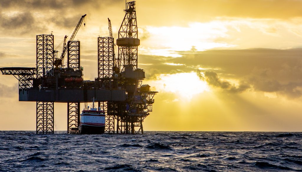
- BP plc building the new oil platform Angelin 40 km offshore of Trinidad (2019). Courtesy https://www.bp.com/en/global/
With annual energy reporting and by allowing free downloads, BP does a great service to the interested public globally.
BP (2019) BP Statistical Review of World Energy. 64 pp. 68th ed. URL www.bp.com. June 2019. Open Access.
Back to top
Home
Antimony traces in mine water, contaminant or resource? Read all about the potential in an Open Access paper by Arnold et al. (2019) (June 12, 2019)
Antimony and arsenic are frequent contaminants in mine water. This may be related to antimony deposits, such as (1) hydrothermal-exhalative sedex deposits of considerable economic importance; or in (2) epizonal hydrothermal replacement ore in limestone and dolomite, controlled by low-permeability traps and fracture zones, and characterized by pronounced silicification; antimonite is commonly the prevailing ore mineral, but deposits that are transitional to magmatic-hydrothermal gold deposits of the Carlin type are known; and (3) metamorphogenic as an epithermal facies of orogenic gold systems and co-product orogenic Sb-Au systems (Pohl in print). Also, antimony is a frequent trace element in deposits of various metals.
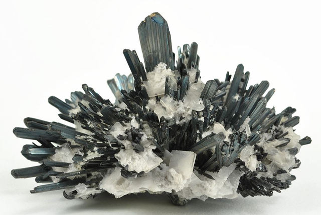
- Rosette of stibnite (Sb2S3) the main antimony ore mineral intergrown with barite (BaSO4). (Courtesy Rob Lavinsky iRocks.com; Wikimedia Commons)
If 'your mine' has a problem of Sb and As in mine water, you must be interested in the paper by Arnold et al. (2019). The authors describe the case of an unnamed operating mine in the Arctic of Finland. They refer to the status of Sb as a 'critical mineral' in the EU (European Commission 2017), which favours considering the pollutant as a resource.
The authors sketch various current methods of Sb removal from water that are used in an environmental and industrial context; they include chemical precipitation, adsorption, ion exchange, membrane separation, and electrochemical techniques. Coagulation, typically using Fe2(SO4)3, has been used for decades to remove Sb and other oxyanions from contaminated waters through a combination of adsorption and precipitation reactions. Novel treatment processes investigated are ion exchange resin, selective ion extraction and ultrafiltration, and electrocoagulation with or without subsequent flotation. All methods are in principle potentially applicable to Sb removal from mine-impacted water. Lab-scale and pilot-scale unit trials demonstrated that recovery of ca. 200 – 500 mug/L Sb from up to 400 m3/h water is possible. Costs of the treatment in 3 scenarios are compared for a 10-year life cycle. The result is that the most economically feasible treatment process for Sb containing mine waters was E-DAF (electrocoagulation-dissolved air flotation).
This paper (Arnold et al. 2019) is rather written for chemical engineers but I suggest that geologists and managers at mines with an antimony-arsenic problem should take notice! By the results of this paper, and as a critical metal, antimony from mine water can definitely be a valuable resource.
References
Arnold, M., Kangas, P., Maekinen, A., et al. (2019) Mine water as a resource: selective removal and recovery of trace antimony from mine-impacted water. Mine Water Env. 38, 431-446. https://doi.org/10.1007/s10230-019-00597-2 Open access
Pohl, W.L. (in print, June 2019) Economic Geology, Principles and Practice: Metals, Minerals, Coal and Hydrocarbons – an Introduction to Formation and Sustainable Exploitation of Mineral Deposits. 2nd ed. Schweizerbart Science Publishers, Stuttgart.
Back to top
Home
Exploitable Marine-Sedimentary Magnesite Deposits in South Australia – Read a Remarkable Recent Paper – Free Access (May 8, 2019)
This paper by Keeling et al. (2019) is fully up-to-date, for example in reporting on magnesite sources, production, ore dressing methods, calcination grades, product uses and global markets. We also learn details of Kunwarara in Queensland. The paper is an important contribution to magnesite geoscience, because it provides a comprehensive description of Neoproterozoic marine-sedimentary magnesite geology in the northern Flinders and Willouran ranges of South Australia (S.A.). What I find particularly helpful for students and practicians of magnesite geoscience is a fairly detailed report on work done to evaluate and develop the sedimentary magnesite resources. Methods used are of the habitually excellent Australian standard. The gist of the paper is the presentation of a newly patented kiln that facilitates capture of pure CO2 and promises to generally reduce emissions from magnesia and cement manufacture (~8% of global anthropogenic carbon dioxide).
Magnesite in the Aidelaide Syncline, S.A., is a minor component of ~800 Ma old shallow marine carbonate rocks called the Skillogalee Dolomite (Keeling et al. 2019). It occurs mostly as thin intraclastic beds of mudpellet conglomerate, rarely as finely bedded micritic magnesite. Extending for about 120 km, magnesite beds ranging from a few centimetres to several metres thickness reach >20% of the sedimentary package over intervals exceeding 100 m. Sequences containing magnesite were deposited in a shallow marine to peritidal setting, with frequent subaerial exposure of mudbanks and a depth of water that rarely exceeded a few metres. Magnesite formed in evaporating shallow seawater; periodic sheetflooding caused by inland rain events spread across extensive low-gradient tidal flats, disrupting and reworking semi-lithified magnesite crusts into highly concentrated mud flows. The entrained solids were redeposited in shallow water as a conglomerate to be reworked by tidal currents. For details, consult Keeling et al. (2019).
Over a distance of 105 km along strike, 10 individual magnesite deposits/prospects have been outlined with combined resources of >500 Mt at >40 wt.% MgO. This represents one of the world's largest known resources of cryptocrystalline (also referred to as 'amorphous') magnesite. Along strike, MgO grade of magnesite tends to be constant. The regular and predictable distribution of magnesite and dolomite interbeds and their similarity in physical properties suggested that selective mining of individual magnesite beds is preferable to bulk mining (see image).
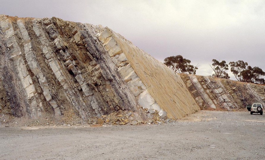
- Myrtle Springs quarry in interbedded dolomite (grey-pale brown) and magnesite (white); magnesite bed 5 cleaned and ready for precision blasting and selective extraction in 1998 (Courtesy Department for Energy and Mining, the Government of South Australia. Photo 46337, sourced 7 May 2019)
Field mapping. measuring of sections and surface sampling (Keeling et al. 2019) guided resource work. Airborne spectral surveys confirmed continuity of magnesite-rich strata along strike. MgO grades were generally measured by total extraction (not excluding dolomite and talc impurities). The largest deposit found is Witchelina, with 215 Mt at 40 wt.% MgO. This grade and high boron being below specifications for high-end uses, other applications are sought. The key to developing a mine may be the Calix Flash Calciner (Calix Limited 2018) that produces a highly reactive CCM (calcined caustic or light-burned magnesia) with a specific surface area >100 m2/g but can be adjusted to produce CCM 300 m2/g. This compares with more typical values of 20‑40 m2/g for lightly calcined MgO (Shand 2006).
Attention: This paper adds ´marine-sedimentary magnesite´ as a new economic deposit type of magnesite, not only as a sedimentological curiosity as hitherto known (Pohl 2019). Explorationists, take note!
Accordingly, the short list of important magnesite deposit types now comprises:
- Ultramafic hosted, or Kraubath type magnesite deposits
- Lacustrine, or Bela Stena type magnesite deposits
- Metasomatic and epigenetic marine carbonate hosted, or Veitsch type
- Marine sedimentary carbonate hosted, or Witchelina type
References
Calix Limited (2018) Calix Limited prospectus. ASX release 19 July 2018. Calix, viewed 8 May 2019, https://www.asx.com.au/asxpdf/20180719/pdf/43wmn3h1znxnsz.pdf
Keeling, J., Horn, R. & Wilson, I. (2019) New kiln technology expands market opportunities for cryptocrystalline magnesite. Mesa J. (Minerals Energy South Australia) 89, 22-38.
Pohl, W.L. (in print, Mai 2019) Economic Geology, Principles and Practice: Metals, Minerals, Coal and Hydrocarbons – an Introduction to Formation and Sustainable Exploitation of Mineral Deposits. 2nd ed. Schweizerbart Science Publishers, Stuttgart.
Shand, M.A. (2006) The chemistry and technology of magnesia. John Wiley & Sons, New Jersey.
Back to top
Home
Deep Drilling in Exploration for Metals and Minerals: Use Coiled Tubing Technology! (April 10, 2019)
Globally, the discovery rate of first rank deposits is not sufficient to replace currently producing mines although the potential is there (Schodde 2019).
What is a first rank (or 'tier 1') deposit?
This category comprises large, long-life, and low-cost mines. In Australia, they typically have a net present value (NPV) at the time of development of >AUS$ 1 billion, mine lives of >20 yrs, they generate a revenue of >AUS$ 300 M/yr, and are in the bottom 20% of the cost curve. Tier 1 deposits contribute disproportionately to global production. They 'make' companies. For more details, see https://minexconsulting.com/definitions/tiers/.
In the future, fewer giant deposits are likely to be discovered near the Earth's surface. Modern large scale underground mass mining may reach down to ~2000 metres. Considering that past exploration merely investigated the first few hundred (say 500) metres below the surface, we may expect that deep exploration offers great rewards. There will be a number of obstacles, of course, including the development and deployment of new concepts and technologies.
Australia is a pioneer of work towards deep exploration. Geoscience Australia persues a precompetitive program (Unlocking Australia's hidden mineral resource potential) that seeks to reveal the ore potential of Australia's buried prospective geology. One example of this work concerns deep crust-penetrating structures, particularly major boundaries between crustal units, that may be important conduits for transport of mineralizing liquids and fluids from the mantle and lower crust into the upper crust. By re-interpretation of deep seismic reflection profiles that depict the crustal profile down to the MOHO across Australia, such structures have been imaged both in known metalliferous provinces (e.g. Olympic Dam) and in greenfield regions (Korsch & Doublier 2016). They have a considerable potential to guide future competitive deep exploration.
Another example of government-assisted innnovation was the foundation of the Deep Exploration Technologies Cooperative Research Centre (DET CRC see http://detcrc.com.au/publications/research/), of which one of the outcomes is the paper by Hillis et al. (2014), which can be downloaded from https://www.researchgate.net/profile/Adrian_Fabris. This paper first describes the motivation for the project, namely to modify the Coiled Tubing Drilling (CTD) technology (that is much used in the hydrocarbon industry; look up, for example, essentialenergy.ca) so that it can be used in metal and mineral exploration. The context is the observation that a wide part of the mineralized Australian basement is covered by younger rocks. Deep exploration beneath this cover is to be facilitated.
Secondly, employing the mineral (metallogenic) system approach, they emphasize the need to observe, measure, and map explorable aspects of the metallogenic system (e.g. hydrothermal alteration halos such as Sb in the Kalgoorlie orogenic gold province). For measuring, sampling and mapping, deep cost-effective drilling is paramount. Real-time downhole and top-of-hole sensing technologies would be integrated.
Third, the principles, advantages, disadvantages and present applications of coiled tubing drilling are at length explained. In their Oilfield Glossary (2019), Schlumberger define the term as: The use of coiled tubing with downhole mud motors to turn the bit to deepen a wellbore. Coiled tubing drilling operations proceed quickly compared to using a jointed pipe drilling rig because connection time is eliminated during tripping. For many years now, coiled tubing drilling is economical in several applications in the oil and gas sector, such as drilling slimmer wells, areas where a small rig footprint is essential, reentering wells and drilling underbalanced (fluid pressure in bore hole is less than the one in host rocks).
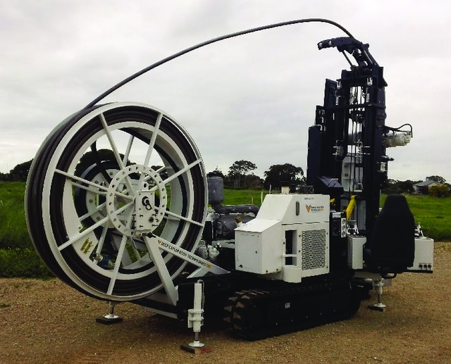
- DET CRC's prototype coiled tubing drill rig. Courtesy Adrian J. Fabris, Geological Survey of South Australia.
Fourth, the Deep Exploration Technologies Cooperative Research Centre (DET CRC) had set itself the aim of developing and testing a greenfields mineral exploration coiled tubing drilling rig, weighing less than 10 t, with the capability of drilling 500-m holes at a cost of less than AUS$50/m, with ancillary safety and environmental benefits. Sampling gear would clean and reinject drill fluids without the need to dig sumps. Sensors were to collect real-time data on petrophysics, structure/rock fabric, geochemistry, and mineralogy. CRC purchased a coiled tubing drilling rig and started developing, modifying, and optimizing CT drilling technology for mineral exploration. First trial holes were sunk. Hillis et al. (2014) describe interesting details such as footprint and halo of metallogenic systems within the IOCG province around Olympic dam and in the Kalgoorlie orogenic gold province.
Hillis et al. (2014) conclude that a grid layout of deep holes should discover first rank deposits, considering the commonly large footprint and anomalous geochemical and mineralogical halo of the giants.
References
Hillis, R.R., Giles, D., van der Wielen, S., et al. (2014) Coiled tube drilling and real-time sensing-enabling prospecting drilling in the 21st century. SEG Special Publication 18, pp. 243–259. Society of Economic Geologists, Inc. (can be downloaded from https://www.researchgate.net/profile/Adrian_Fabris)
Korsch, R.J. & Doublier, M.P. (2016) Major crustal boundaries of Australia, and their significance in mineral systems targeting, Ore Geol. Rev 76, 211-228. doi: 10.1016/j.oregeorev.2015.05.010
Oilfield Glossary (2019) URL https://www.glossary.oilfield.slb.com/ Accessed April 2019. Schlumberger Limited.
Schodde, R. (2019) Exploration and discovery of base and precious metal deposits in the Pacific Rim over the last 50 years. Presentation: PACRIM 2019 Mineral Systems of the Pacific Rim Congress, Location: Auckland, New Zealand. Free Download from MinExConsulting.com.
Back to top
Home
Open Access Paper on the 'Orogenic Gold System' by Damien Gaboury – Highly Recommended (March 11, 2019)
Gaboury's review published in Applied Earth Science is excellent. Professionals in exploration, mining and in economic geology research will find the paper highly useful. It refers mainly to recent publications that have demonstrated or refined various aspects of gold deposit formation. Let me report some of the main statements:
The term 'orogeny' (adjective orogenetic, or orogenic) describes the process system that formed geologically young mountain belts and ancient fold belts. Both are characterized by structures such as thrusting, folding and brittle faulting in the outer and higher layers, and ductile folding and shearing, metamorphism and plutonism in the inner and deeper parts (definition adapted from Neuendorf et al. 2005). The denomination 'Orogenic gold deposits' was introduced and popularized by D.I. Groves and his team, beginning in 1993 (e.g. Groves et al. 1998). The term purposely avoids a precise petrogenetic-tectonic process-related classification such as magmatic-hydrothermal or metamorphogenic in order to stress the coherence of the metallogenetic system (the 'crustal continuum model').
Increasingly in economic geology, a systematic approach to the investigation of mineral deposits is applied (see my blog 20 April 2017). After Wyman (et al. 2016), Gaboury (2019) takes this method to the orogenic gold deposits, reviewing (1) the fluid sources; (2) the appropriate ligands and their sources; (3) the solubility of gold and its sources; (4) the function of faults as conduits; and (5) the mechanisms of gold precipitation.
As a source of the mineralizing fluids (1), the author presents sea floor rocks and black shales, and their metamorphic dehydration and desulfidation during orogenic metamorphism at the greenschist/amphibolite facies transition; the transformation of chlorite to amphibole and pyrite to pyrrhotite liberating water, HS- and Au, at ca. 550 degrees C and 2-10 kbar, typically late in orogeny. Compared to the pressure maximum, the thermal maximum is retarded for 10-100 My. This is very well demonstrated in the PTt diagram of Figure 2 (Gaboury 2019), based on modelling by Connolly (2010).
Ligands (2) for gold in metamorphic fluids may be S- or Cl- but sulfur dominates. Like water, S is released at 550 degrees C. (3) The author suggests that Au is mainly sourced from organic-rich pelites that contain diagenetic auriferous (As-) pyrite. Earlier, Gaboury had reported organic matter-derived ethane in fluid inclusions of gold quartz. Others (citations in Gaboury 2019) contributed additional evidence for an organic carbon-rich source. Various structures may provide conduits for fluid flow (4) into the upper crust. High transport capacity is characterized by solitary wave propagation. While enhancing flow high fluid pressure triggers seismicity on the faults and the commonly moderate deformation seen in gold deposits. (5) In (ƒO2) and pH diagrams of gold solubility, the maximum occurs at near neutral pH, and ƒO2 just below the sulfate‑sulfide (oxide‑sulfide) mineral stability boundary (Gaboury 2019). In host rock alteration, reducing state may be reflected by Fe2+-rich minerals of alteration halos and veins (e.g. pyrite, ankerite) or if oxidized, by the presence of both oxidized (sulfate and sulfur dioxide, magnetite) and reduced (H2S) sulfur forms. Changes such as phase separation of CO2 cause acidification and consequent gold precipitation, and proximal sericite alteration.

- Cut and polished slab of gold ore (from O'Dea Vein or Irishman Vein, Grant Mine, Fairbanks Mining District, Alaska, USA. Author James St. John (Wikimedia Commons). Gold-quartz-sulfide hydrothermal vein from the Late Cretaceous of Alaska, USA (Public display, Leadville Mining Museum, Leadville, Colorado, USA)
Finally, Gaboury (2019) provides tangible advice for exploration. Favourable are volcano‑sedimentary belts, high heat flow, intrusive bodies at depth, late felsic dykes preceding mineralization, faults with sericite margins and quartz carbonate veinlets. The best source rocks for orogenic gold are black shales. I would add that if exposed, the carbonaceous source sediments would be graphite schists.
This paper is highly recommended. It is clear and concise. Its genetic assertion of a dominantly metapelitic source of orogenic gold is well argued. The existence of granite-related magmatic hydrothermal deposits among the orogenic type is acknowledged (Gaboury 2019). Yet, deep adakitic monzodiorites in the Golden Mile are similar to gold-bearing porphyries worldwide; Mueller et al. (2016) suggested that these magmas delivered a significant component into the giant hydrothermal gold mineralization system. Therefore in my opinion, the 'superclass' of orogenic gold deposits should be split up into more homogeneous genetic (sub‑) classes.
References
Connolly, J.A.D. (2010) The mechanics of metamorphic fluid expulsion. Elements 6, 165‑172.
Gaboury, D. (2019) Parameters for the formation of orogenic gold deposits. Applied Earth Science. Open Access: https://doi.org/10.1080/25726838.2019.1583310
Groves, D.I., Goldfarb, R.J., Gebre-Mariam, M., et al. (1998) Orogenic gold deposits: A proposed classification in the context of their crustal distribution and relationship to other gold deposit types. Ore Geol. Rev. 13, 7‑27.
Mueller, A.G., Hagemann, St.G. & McNaughton, N.J. (2016) Neoarchean orogenic, magmatic and hydrothermal events in the Kalgoorlie-Kambalda area, Western Australia: constraints on gold mineralization in the Boulder Lefroy-Golden Mile fault system. Miner. Deposita DOI: 10.1007/s00126-016-0665-9
Neuendorf, K.K.E., Mehl, J.P. & Jackson, J.A. (eds) (2005) Glossary of Geology. 5th edn. 779 pp. American Geological Institute.
Wyman, D.A., Cassidy, K.F. & Hollings, P. (2016) Orogenic gold and the mineral systems approach: Resolving fact, fiction and fantasy. Ore Geol. Rev. 78, 322-335. https://doi.org/10.1016/j.oregeorev.2016.04.006
Back to top
Home
A Remarkable New Book: Origins, How The Earth Made Us. By Lewis Dartnell (February 12, 2019)
First allow me to cite a few phrases from the book that provide glimpses into content and style. The author writes, for example:
"I want to explore how the Earth made us. The great transitions in climate and landscapes caused by rifting in Africa during the Mid-Tertiary opened the path for our ancestors to evolve into today's humanity, the planet's dominant eukaryotic species. "
"It was our planet's active geological forces that drove our evolution as a uniquely intelligent, communicative and resourceful kind of ape while a fluctuating climate enabled us to migrate around the world to become the most widely spread animal species on Earth."
"The Earth has also provided us with the raw materials we've extracted, refined and assembled into our tools and technologies, from the roughly fashioned hand axes of the early Stone Age to today's computers and smart phones."
The book comprises nine Chapters that take a comprehensive view of Earth processes and the evolution of humanity. Titles are intuitive such as (1) The Making of Us; (2) Continental Drifters; ... (5) What We Build With; (6) Our Metallic World; ... and (9) Energy.
The last ends with a pointer to the potential of nuclear fusion sating the giant energy needs of a decarbonized future.
The book provides a fresh story of human evolution in the geological context. Don't expect an evenly detailed treatment; the strength of the book is the illumination of great features and connections. With limited use of science terms, the author admirably explains diverse themes such as the origin of coal, the trade winds, or the workings of Plate Tectonics. The science content, however, is very much up to date.
This is a wonderful and entertaining book, rich in often surprising insights. I recommend it for Earth scientists, teachers, students and practicians as well as for the broad reading public.
The book should be available at Amazon.uk. Living on the Continent, however, I received my copy of the English version only from Amazon.de. The Brexit?
References
Dartnell, L. (2019) Origins: How The Earth Made Us. 346 pp. Penguin, The Bodley Head.
* Find Lewis' website at the URL http://lewisdarnell.com/en-gb/
Back to top
Home
Mining, Ophiolites, CO2 and Climate Change: an Astonishing Discovery (January 10, 2019)
Good practice in modern mining avoids or minimizes greenhouse gas emissions. Conversely, climate change may negatively affect mines in various ways and resilience against this risk needs to be integrated into mine planning and sustainability management.
Water issues are central, ranging from drought that endangers supply to extreme precipitation that may flood pits and destabilize tailings dams. Generally, a well-planned water management is indispensable throughout the whole life-cycle of every mine, from the stage of feasibility and environmental impact studies to post-closure care. Mine-site water management should always consider the entire catchment. Hydrological studies must be based on data of several annual cycles. Extreme rainfall and snow-melt are the common cause of dam breaks, landslides and mudflows. Clearly, upper and lower bounds of all hydrologic conditions affecting a mine must be determined. Best practice approach is to establish a monitoring network that assembles weather, surface and groundwater data. Initial models of water quality and flow are continuously updated.
Climate warming should be considered in predictive forecasts, e.g. for large open pit operations. Currently, however, actionable, or bankable, information on the future climate and consequent averages and weather extremes for specific locations is not available. Generally, increasing precipitation is expected but in prediction, wide error margins are unavoidable. Climate research provides drastic prognostics that the current warming path takes us into a new hothouse Earth (see my blog dated August 15, 2018).
Hothouse states of the Earth are typically linked to profuse CO2 outgassing from LIPs (large igneous provinces), extinction, global warmth, high sea levels, no ice, ocean acidification, anoxia and euxinia, and desert expansion. In the Holocene, we are still at interglacial conditions, emerging from an icehouse state of the Earth (cool, no deep oceanic anoxia, major polar ice caps, strong thermal oceanic circulation).
CO2 (atm) correlates positively with T in hot, moderately hot (greenhouse) and cold states of the Earth system. This raises the question, how CO2 is withdrawn from the atmosphere? What are the feedback cycles and natural CO2 sinks that eliminate the excesses and cause the icehouse states of the Earth? Previous answers to that question are many (e.g. orogeny, burial of carbon in coal or black shale, etc.) but remained unsatisfying.
Meanwhile, the strong propensity of ultramafic rocks for weathering by carbonatisation has been noted to offer a potential for geological CO2 capture and storage (Kelemen et al. 2011). This way, mines that process ultramafic-hosted ore (e.g. Ni, Cr, asbestos, magnesite) sequester enough carbon dioxide from the atmosphere to more than offset greenhouse gas emissions from operations (Wilson et al. 2011). The principle is illustrated in the following reaction:
Magnesite formation from dunite: Mg2SiO4 (Forsterite) + 2 CO2 aq = 2 MgCO3 (Magnesite) + SiO2 aq
The discovery: At a recent AGU conference, Francis Macdonald (University of California, Santa Barbara) reported to have identified the major cause that triggers ice ages (Voosen 2019): The prime agent of atmospheric CO2 drawdown appears to be the obduction of ophiolites, combined with tropical weathering, and consequent carbonatisation of ultramafic and mafic rocks, as demonstrated by Macdonald for the last 500 My, repeatedly triggering icehouse Earth conditions. The recent ice ages are attributed to the southeast Asian ophiolite islands. Finally, Macdonald reminds us that the planet's default state appears to be the hothouse (Voosen 2019). Macdonald and his team already formally published their paper later in 2019.
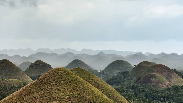
- Peculiar morphology caused by tropical weathering, Bohol Islands, Philippines (Wikimedia Commons 2019)
We have to wait for the ophiolite weathering control of glaciations to be affirmed and not found falsifiable. As geologists we know and cannot but accept that the default state of global climate is the hothouse. The return into a hothouse climate will not be tomorrow. At present, reducing greenhouse gas emissions is the chosen counteraction. Yet, I believe that humanity should start serious research and experiments into mitigation of climate warming consequences and the various techniques of geoengineering, also called climate intervention, or climate engineering. Not less, but more science and technology is the solution!
References
Kelemen, P.B., Matter, J., Streit, E.E., et al. (2011) Mineral carbonation in peridotite: natural processes and recipes for enhanced, in situ CO2 capture and storage. Ann. Rev. Earth Planet. Sci. 39, 545-576.
Macdonald, F.A., Swanson-Hysell, N.L., Park,Y., et al. (2019) Arc-continent collisions in the tropics set Earth’s climate state. Science 364, 181-184. DOI: 10.1126/science.aav5300
Voosen, P. (2019) Tropical uplift may set Earth's thermostat. Science 363 (6422), p 13.
Wilson S.A., Dipple G.M, Power I.M., et al. (2011) Subarctic weathering of mineral wastes provides a sink for atmospheric CO2. Environ. Sci. Technol. 45, 7727-7736.
Back to top
Home
